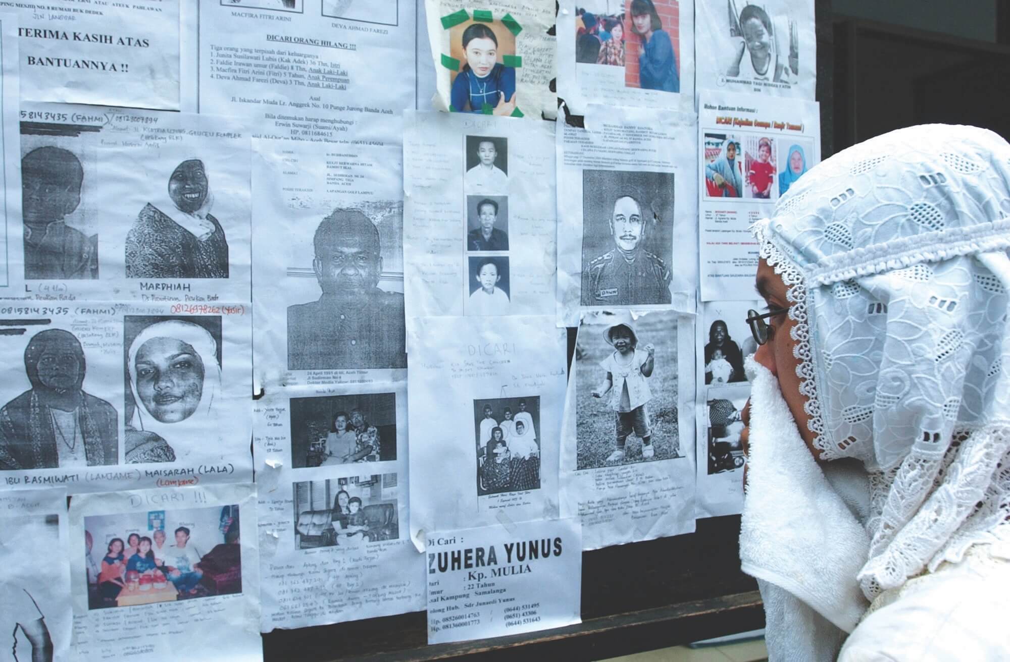


On 26 December 2004, Andi Azhar Rusdin was a high school student who loved math and physics. Like many others, he was shocked by the tragic news of the Aceh tsunami unfolding that day.
Andi Azhar was born and raised in Makassar, around 3,000 kilometres from Aceh. Little did he know that two decades later, he would end up in Aceh leading efforts to monitor and respond to such disasters as the head of the Aceh Besar Geophysics Station at the Indonesia Agency for Meteorology, Climatology, and Geophysics (BMKG). Reflecting on the station’s evolution over the past twenty years, he shared his insights with The ASEAN.
“Geophysically, Aceh is highly prone to earthquakes and tsunamis,” Andi Azhar explained. “There are two major earthquake sources in the region: the subduction zone between the Indo-Australian and Eurasian plates to the west of Aceh, and several active fault zones, such as the Aceh Fault, Seulimeum Fault, Batee Fault, Tripa Fault, and Lhokseumawe Fault. Some of the most destructive earthquakes have occurred here, including the massive 9.1-magnitude quake on 26 December 2004, which triggered the devastating tsunami.”
That disaster marked a turning point for BMKG’s operations in Aceh. “It opened our eyes to the urgent need for robust earthquake monitoring and tsunami early warning systems in disaster-prone areas,” Andi Azhar said. “Before the tsunami, our resources were extremely limited—there was only one earthquake sensor in Banda Aceh, and it took hours to analyse seismic events using the outdated Shell Processing Support (SPS) 3 system.”
Afterwards, there was a significant upgrade in monitoring capabilities. “Today, Aceh has at least 28 operational seismographs, and our analysis tools have greatly improved with the installation of Seiscomp4, a widely used software for real-time earthquake and seismic event monitoring, which allows us to analyse earthquakes in under five minutes.”
Andi Azhar also explained how access to early warning information has been streamlined. BMKG now disseminates earthquake and tsunami alerts through various channels, including websites, social media, and the Warning Receiver System New Gen (WRS NG), installed in 27 locations across Aceh, primarily in BPBD (Local Disaster Management Agency) offices. “The station also uses an Automatic Warning Broadcast (AWB) system and has eight tsunami sirens throughout Banda Aceh, Aceh Besar, and Aceh Barat to assist with evacuation efforts.”
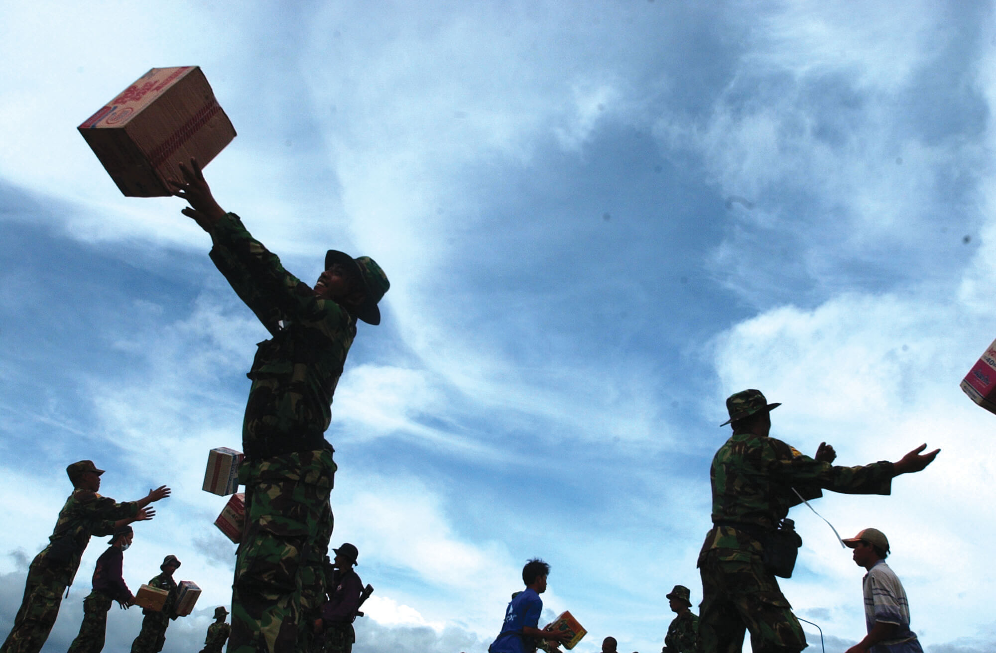
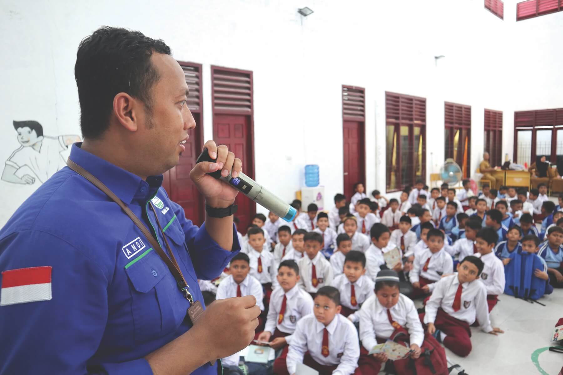
On top of the monitoring effort, public education has been another key focus. “At BMKG Aceh Besar Geophysics Station, we regularly engage with the community through initiatives like the Earthquake and Tsunami School, as well as BMKG Goes to School. These initiatives have reached thousands of people,” Andi Azhar noted.
Feedback from Aceh’s residents has been overwhelmingly positive. “Many have expressed gratitude for our awareness-raising efforts and have called for these activities to be conducted more frequently to ensure the message reaches all parts of the community,” Andi Azhar added.
The views and opinions expressed in this article are solely those of the interviewee and do not reflect the official policy or position of ASEAN.